|
| *****SWAAG_ID***** | 9 | | Date Entered | 09/01/2011 | | Updated on | 13/12/2011 | | Recorded by | Tim Laurie | | Category | Burnt Mound | | Record Type | Archaeology | | Site Access | Public Access Land | | Record Date | 01/01/2005 | | Location | The lower of two burnt mounds on the stream which flows down through Stolleston Wood | | Civil Parish | Ellerton | | Brit. National Grid | SE 058 971 | | Altitude | 315m | | Geology | Shales below Underset Limestone. | | Record Name | Ellerton Moor. Burnt Mound above Stolleston Wood. The Lower of two sites on the same stream. | | Record Description | East bank of stream.This is the lower of two burnt mounds located on the banks of the same spring stream. The upper site is the larger of the two, see HER Site 152.
These two burnt mounds, together with a third burnt mound located at the base of the slopes of Black Hill, some 500m to the SE, are elements in a complex of settlement remains on Ellerton Moor comprising field system, standing stone, scattered stone cairns and at least one ring cairn. All these features remain unsurveyed. | | Dimensions | Large, high* | | Additional Notes | Indicative Dimensions:
Size: Small <6m, Medium 6m-9m, Large 10m-15m, Extra large >15m.
Height: Low <0.5m, Average 0.5-1.0m, High >1.0m.
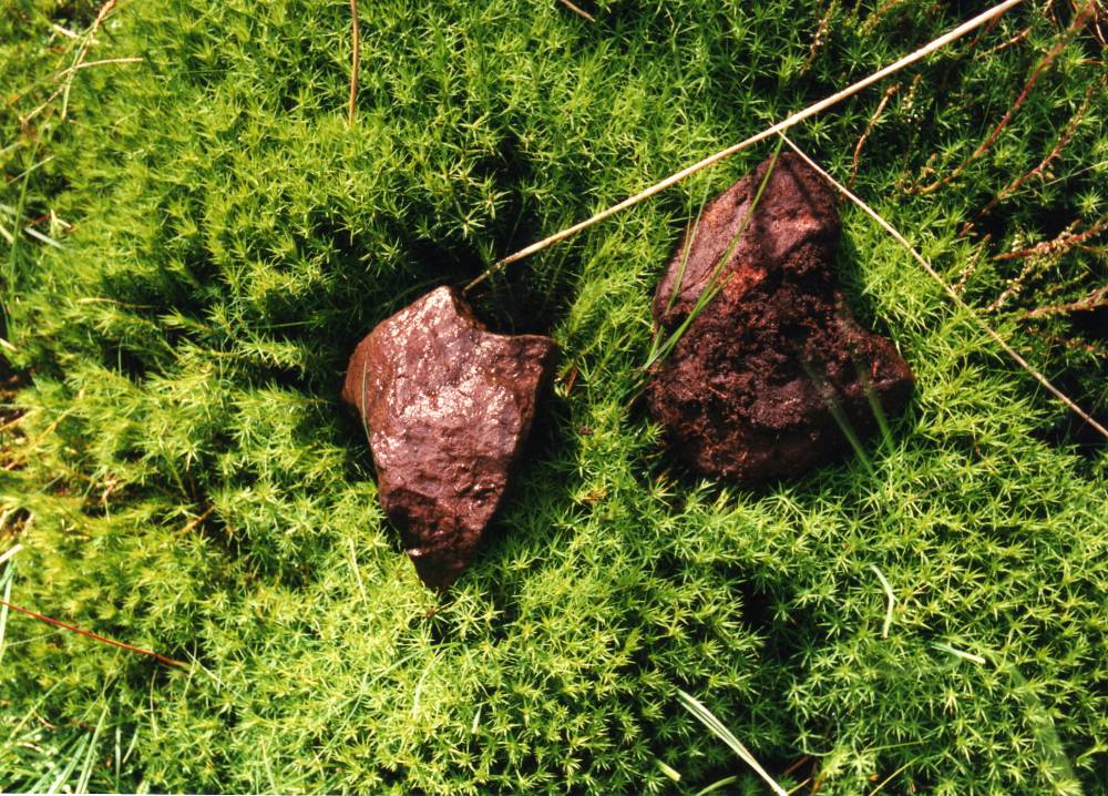
Burnt mounds are crescentic or circular mounds of fire cracked , reddened sandstone. They vary in size from 4m to 18m diameter and can be more than 2m above present ground level.
In the Eastern Dales, their regular distribution at springs at 1-2km intervals on the Dale Sides may represent the distribution of contemporary transient settlements with which they were associated.
They are numerous throughout Britain and their distribution is not limited to the Uplands. Their use as sweat house saunas seems most probable in the absence of any evidence for cooking. Radiocarbon dates from burnt mounds have been obtained from as early as 2400CalBC to around 800 CalBC, most are of Middle Bronze Age date.
The six burnt mounds at the spring line overlooking Harker Mires of which this is the largest, are an important component in the Bronze Age landscape complex centred on the ring cairn and cairnfield (Grinton 2650) 150m to the North of this site. They may be the earliest evidence for transient seasonal occupation of this well watered elevated terrace. The small low energy stream would have provided ideal habitat for beaver whose silted up dams (Bryony Coles, 2006) may have caused the formation of fertile mesa pastures attractive to fauna and most suitable to pioneering arable settlement- such as the the cairnfield and paddock like fields on Harker Mires.
Many burnt mounds throughout the Dales are located at the spring rise of lateral, low energy streams which flow parallel to and across the elevated terrace below the Underset Limestone before turning at right angle to fall abruptly to the floor of the dale below.
References
Coles, Bryony. 2006. Beavers in Britain�s Past. Oxbow.
Laurie,T.C. 2003. Researching the Prehistory of Wensleydale, Swaledale and Teesdale, in �The Archaeology of Yorkshire-an assessment at the beginning of the twenty first century�. Leeds: Y.A.Soc Occ Pap 3, 223-34.
Laurie , T.C. 2004. �Burnt mounds in Wensleydale and Swaledale�. Leeds: Y.A.Soc Occ Pap 2,79-88.
Laurie, T.C 2007. � Enigma excavations - The Sturdy Springs Burnt Mounds, October 2006�. Conservation Update, Defense Estates. 2007.
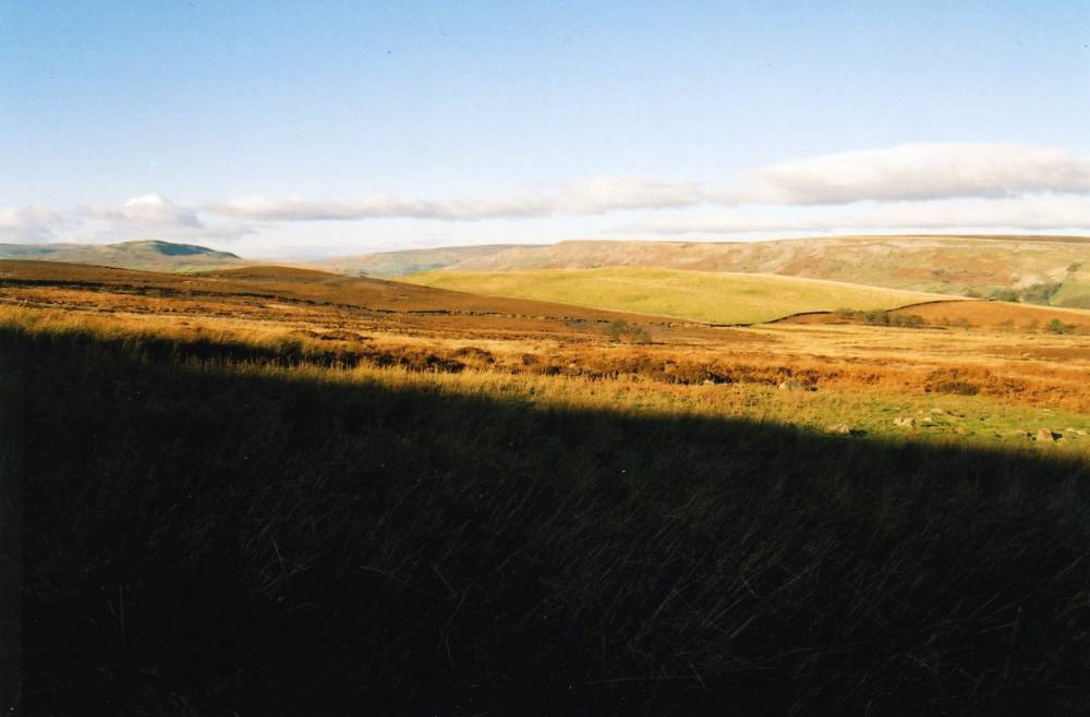
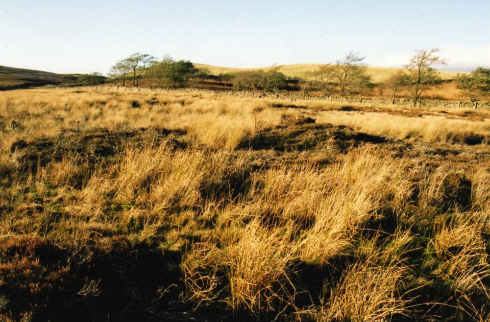
| | Image 1 ID | 409 Click image to enlarge | | Image 1 Description | View westward from Black Hill towards the two burnt mounds above Stollerston Wood. | 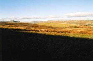 | | Image 2 ID | 410 Click image to enlarge | | Image 2 Description | The Stollerston Wood burnt mound | 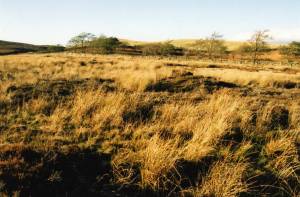 | | Image 3 ID | 411 Click image to enlarge | | Image 3 Description | Fire cracked sandstone from Stollerston Wood burnt mound. |  |
 |
|